OpenTopoMap Viewer is a lightweight Android app for outdoor navigation and offline maps. With OpenRouteService (ORS) integration, you can calculate routes directly on the map for hiking, cycling, driving, and more. This guide shows you how to enable basic routing step by step.
Contents
1. Register for an ORS API Key
To use routing in OpenTopoMap Viewer, you need an API key from HeiGIT:
- Go to account.heigit.org.
- Create a free account.
- Generate a new API key and select the Basic plan.
👉 For more details, see: How to make an API token (HeiGIT/ORS).
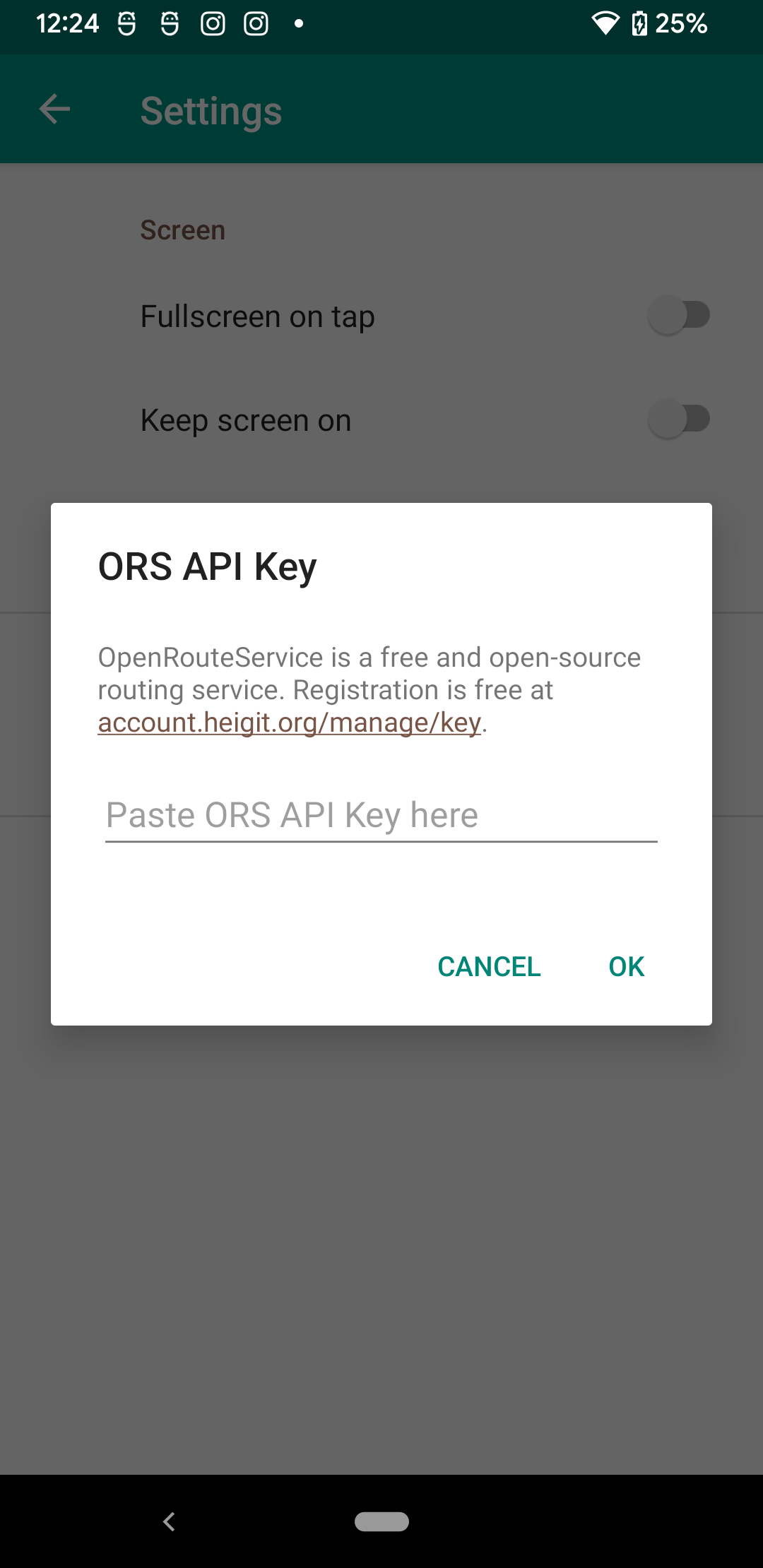
2. Add Your API Key in OpenTopoMap Viewer
- Open OpenTopoMap Viewer.
- Go to Settings → OpenRouteService (ORS).
- Tap the HeiGIT URL to copy your API key.
- Paste the key into the API key input field.
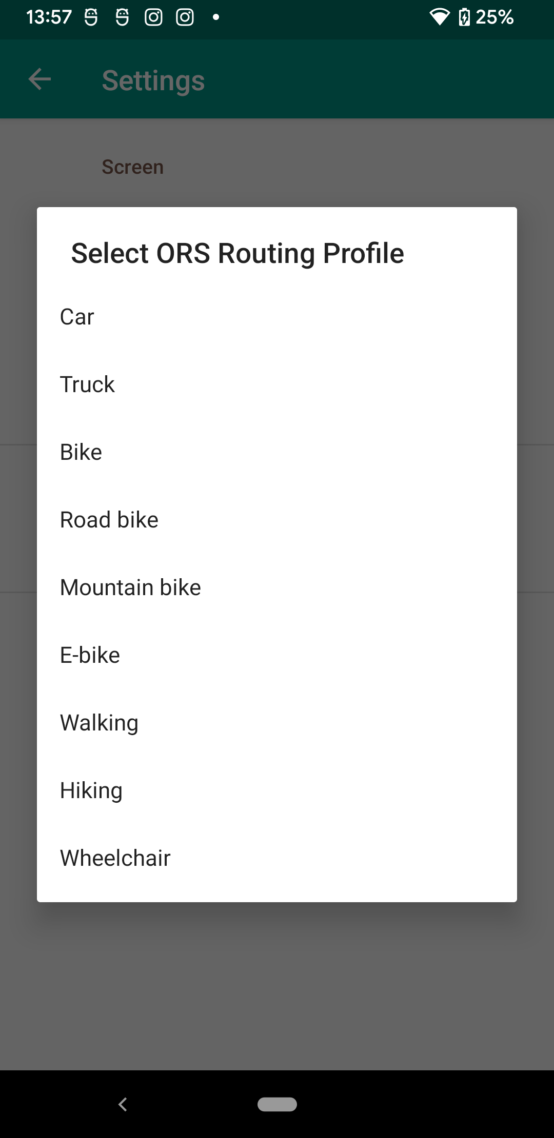
3. Select Your Routing Profile
After adding your API key, a new setting becomes available: Routing profile.
- Open Settings → Routing profile.
- Choose your transportation mode: 🚶 Walking, 🚴 Cycling, 🚗 Driving.
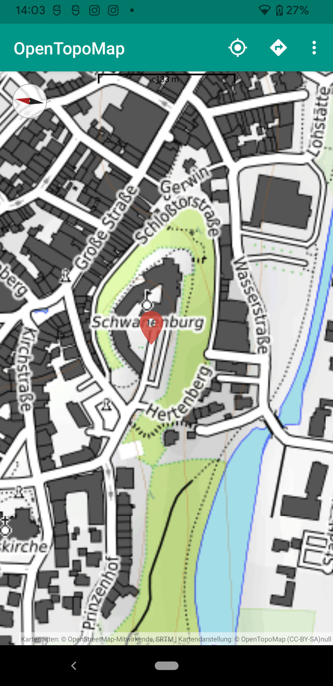
4. Plan a Route on the Map
- Return to the map view.
- Long-press on the map to place a marker.
- Tap the marker to open its info balloon.
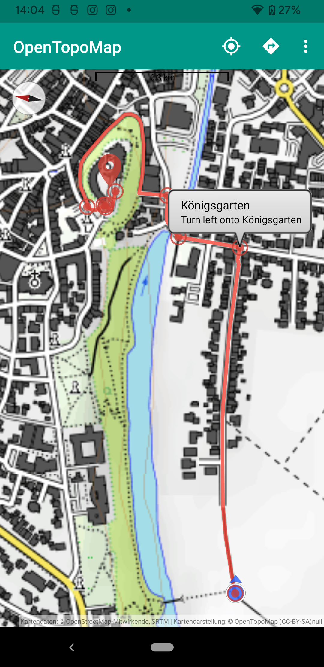
- Tap the “add waypoint” icon in the top-right corner.
A route will be calculated from your current location to the marker position using OpenRouteService.

Conclusion
That’s it! You’ve enabled basic routing with ORS in OpenTopoMap Viewer. With your free HeiGIT API key, you can now plan outdoor trips, hiking tours, and bike rides directly within the app.
- ✅ Register at account.heigit.org
- ✅ Add your API key in Settings → OpenRouteService
- ✅ Select your routing profile
- ✅ Long-press on the map to calculate your first route